
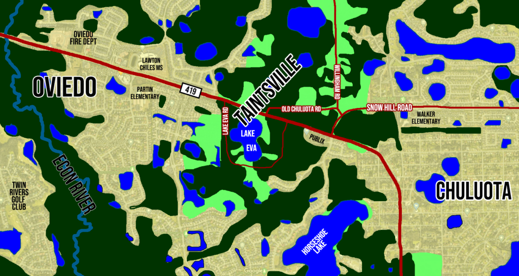
The Village of Taintsville
Residents who lived in the rural community between Chuluota and Oviedo lacked an identity, so they created one.

Before suburban sprawl gobbled up most of the wilderness that served as a buffer between towns, there were more “in between” areas in eastern Seminole County. For rural residents caught somewhere in the middle, it was sometimes hard to explain where exactly they lived.
This was an increasingly frustrating problem for early 1970s residents around Lake Eva, then about three miles east of Oviedo and a mile west of Chuluota. Packages sometimes were not delivered and giving directions was a challenge.
“We are tired of telling people we live behind the fire tower on the road that doesn’t have a name,” said local Theodore Peterson.
The idea of inventing their own town began to circulate among the 30 or so neighboring families. It was said jokingly at first, but the suggestion got progressively more serious. They had no desire to formally incorporate; they just wanted to live somewhere. Besides that, they wanted to remain distinct from the two larger towns that sandwiched them — especially from fast-growing Oviedo, which seemed to have annexation fever.
In one such conversation, then-teenager Boyd Best was tending the yard of Les and Mary Gross. He complained about the difficulties of telling friends where you live when you live nowhere.
“We ‘tain’t in Chuluota and it ‘tain’t in Oviedo either!” he exclaimed. And with that simple utterance, “Taintsville” was born.
Word quickly spread, and the locals embraced the name. All were eager to make it stick. The Gross and Cochran families went in together and ordered two highway signs for $50 each from a company in Texas. Another neighbor, Ted Peterson, contributed some concrete.
One dark Sunday night, the posse of town founders headed out after midnight. Stealthily, they installed the markers one mile apart on either side of the unauthorized village limits.
A survey crew had been working in the area that week. They were rightfully confused when they returned to their task that Monday morning. Were they even in the right place?
“When the survey crew came back,” Mary Gross recalled, “they didn’t know what to think. Here they were in a town that didn’t exist when they left!”
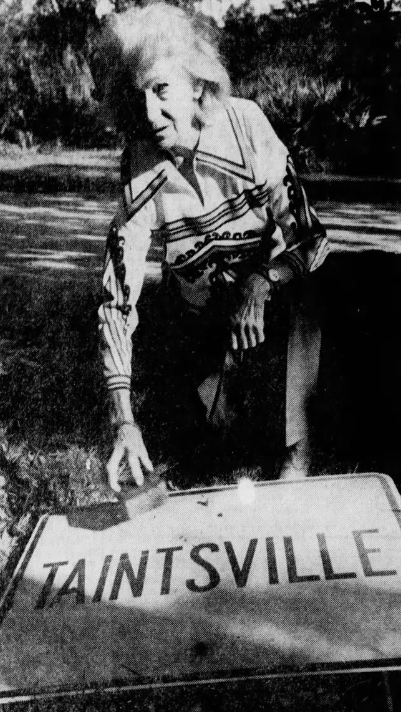
For a few days, county and state bureaucrats weren’t sure what to think about the mysterious new hamlet. The signage looked professional enough, and each assumed the other had placed it. About a week later, the jig was up, and the government removed the signs.
The 30 families of the would-be town refused to give up so easily. In the fall of 1971, they began circulating a petition. Finally, the crew got their chance. Commissioner Greg Drummond met with the townspeople at the old fire tower and agreed to add their request to the Commission’s December 14th meeting agenda.
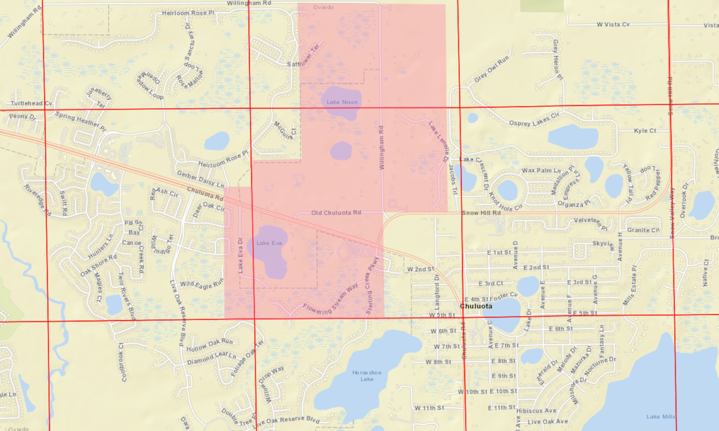
The informal organization, representing the majority of the prospective town’s inhabitants, showed up in force, and apparently, they were quite convincing. The board agreed to recognize the 700-acre area as “Taintsville.”
Rand McNally caught on not long after that, and the Village of Taintsville was added to its famed maps. With boundaries encompassing both sides of the highway and over one square mile in total area, original Taintsville claimed a population of 80 citizens.
Emboldened by their success, residents thought, why not name the roads too? Another sign was secretly erected on an unnamed dirt road that ran through the village. A hand-painted sign labeled the path “Tainta Road.” However, the county wasn’t as eager to humor local comedians this time, and it was soon redubbed “Old Chuluota Road.”
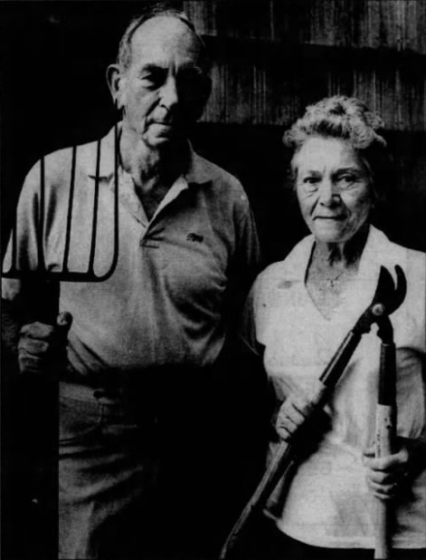
Over the years, the town has had at least two de facto mayors. The first was Alfred Best (father of the boy who came up with the name), who had lived there since 1942. Then there was Les Gross, perhaps the most prominent resident, who “served” in the purely imaginary role until his death in 1988.
Besides its unique name, the most notable thing in town happened before the moniker. Legendary poet Robert Frost was a friend and frequent guest of Robert Lamont (former editor of The Atlantic) and his family on Lake Eva during the fifties and early sixties.
Today, the village is a rural island amid the suburbs. The independent spirit of its founders still lives on with current residents. Its multi-acre homesteads starkly contrast to the planned neighborhoods abutting it on three sides. The city limits of Oviedo have come right up to its borders, but annexation and development have so far been chiefly averted.
Can Taintsville survive continued urbanization? Will locals allow the name to stand despite the unfortunate modern appropriation of its root word? Time will tell!
This post is 3282 days old. Comments disabled on archived posts.