
Brick Highways of Orlando: The Fading of Highway 22

During the 1910s and 1920s, brick roads connecting towns throughout Florida were all the rage. The few remaining today are fading fast.
One hundred years ago, in 1916, brick highways were considered state-of-the-art. The now antiquated paving material was a revolutionary advancement over the past methods, primarily dirt or shell paths perhaps topped with a layer of pine needles. When Florida’s notorious afternoon showers came around, these thoroughfares became muddy sloughs.
The brick paving party was kicked off in Orange County in 1913 when voters approved a $600,000 bond. The snake-like network of dirt roads connecting Central Florida’s many small towns began to be converted to brick, primarily by prison labor. However, the prominence of brick pavers lasted just two decades.
In the days before Highway 50, the main east-to-west route in the western Orlando area became known as State Road 22 or Winter Garden Road. Its path roughly followed State Road 438, going east from Oakland before taking a southward cut through Ocoee. From there, it cut south and east, eventually meeting what is now Old Winter Garden Road through Orlovista until it finds Washington Street near the Paramore district in Orlando.
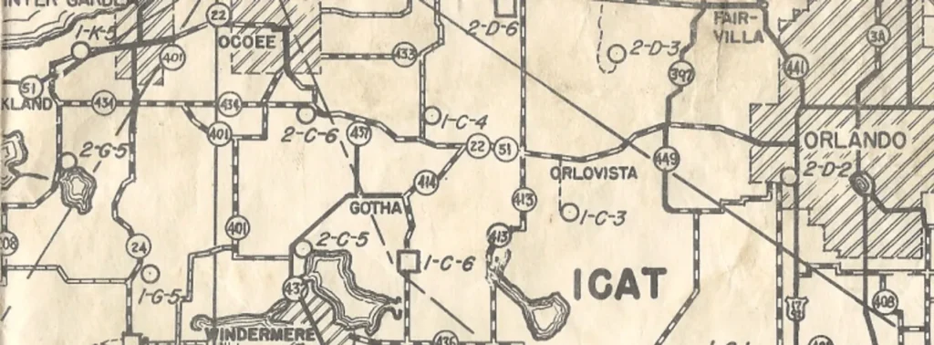
This route had a notorious reputation. The nine-foot-wide brick highway was incredibly curvy. Old-timers counted 26 curves, some tight hairpin angles, between Winter Garden and Orlando. Even with the bumpy bricks and lower-powered automobiles keeping speeds down under 35 miles per hour, there were often severe accidents.
Over the years, almost all of these old brick roads have been paved over, developed, or otherwise destroyed. Few original examples exist; one stretch remained until recently in what was once known as Minorville — south of Ocoee — in the form of Main (or Maine) Street, a small section of road that juts off of Bluford Avenue one mile from historic downtown Ocoee.
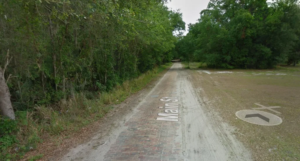
This particular part of the old highway was once the primary route to Orlando, a trip that could then take up to an hour by car. The stretch of old brick road was saved because, in 1936, it was bypassed by a new, smoother, straighter asphalt route that would later become part of Highway 50 (known locally as Colonial Drive).
Although it had not been maintained for many decades and had long faced the problem of folks stealing bricks for souvenirs, the half-mile length survived with minimal usage into the 2010s. Many locals felt like something needed to be done to save it.
Various attempts were made in the 1990s to preserve it, including plans to bury the old bricks under layers of dirt. And then, finally, the decision was made that the only way to protect it… was to destroy it. Plans were underway in 2014 to develop the area into one of those new urbanized downtown live/work/play districts in what will soon become known as City Center West Orange.
Below you can see the gradual fading of the old route over seven years of Google Street View, as the plans for the new development and new Maine Street are executed immediately to its south.
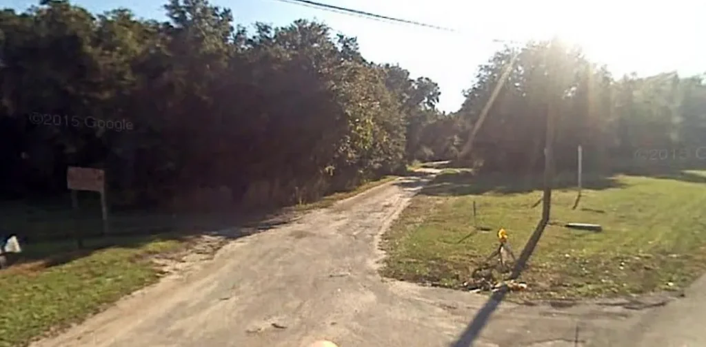
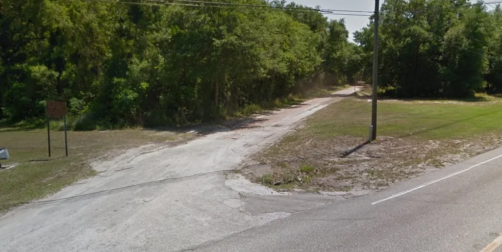
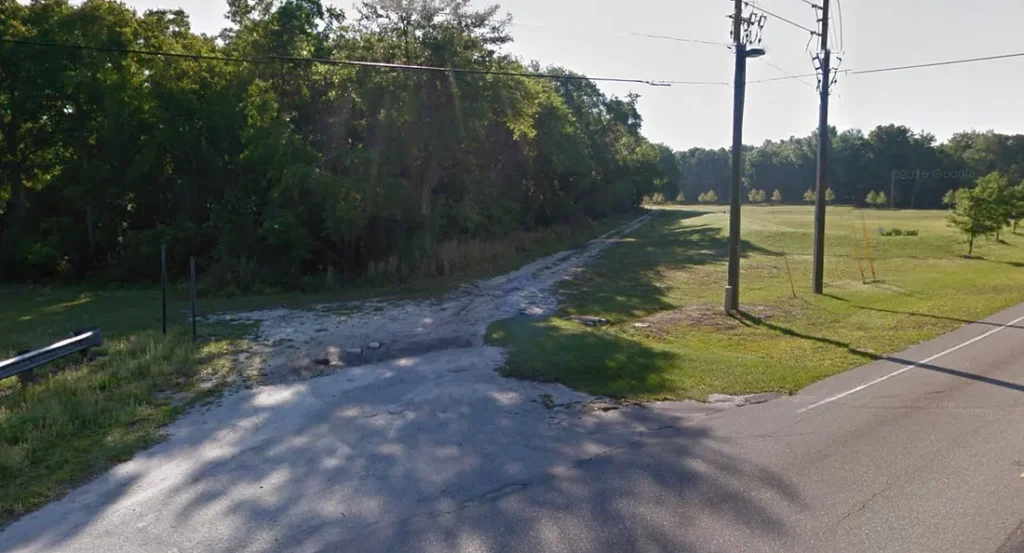
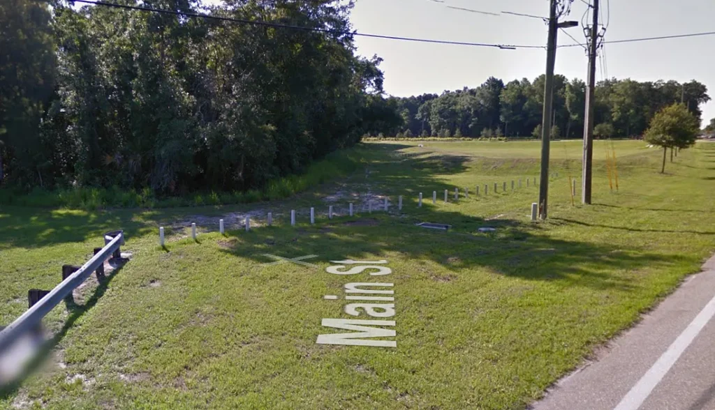
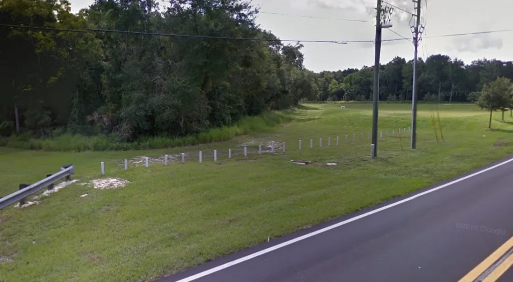
Today the old path is still visible but devoid of its original bricks. Fragments of the bricks and curbs on the side can be found. Traffic can no longer pass on it. However, all is not lost.
Though saving the old road would have been nice, the funds to maintain it would not likely come. It would continue to deteriorate. So with the economic development ball rolling, the city constructed a new Maine Street just along the south side of the old road. All of its intact bricks were removed, cleaned up, and placed in the median of the new road.
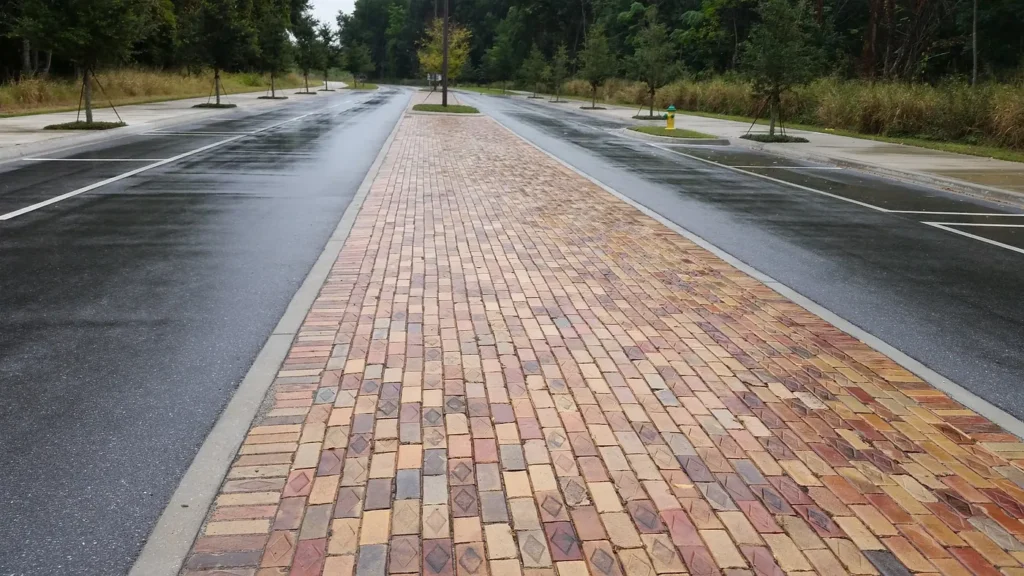
Construction on the $150 million, 60-acre development began in November 2015. It will sit on the shores of Lake Bennet and overlook Highway 50 to the south. Initial plans pegged it to be completed in 2017 — a majorly over-ambitious deadline. As of April 2023, it is still under construction, with a Phase 1 opening scheduled for 2026. (Latest updates are on their Facebook page)
While it’s great that the bricks have been preserved, it’s sad to see the old road quickly fade from view. If you’re a geek for old roads like me, do yourself a favor and visit it before it’s completely gone. Might as well check out the old cemetery and the historic district while you’re there.
Also, check out the recently rediscovered African American cemetery north of town, which dates to the Ocoee Massacre.
During my visit in November 2014, I ate at the Ocoee Cafe. At this old, small-town diner, I met (the now-passed) Raymond “Junior” Crawford, who had been in Ocoee since 1931, and we had a delightful chat over lunch. Everyone in the diner knew Junior; he had been a regular for decades. I wish I had gotten more time to spend with him. You don’t get too many opportunities to sit down with living history!
Let me know in the comments how it looks today.
This post is 3763 days old. Comments disabled on archived posts.